Being the use of UAVs for agricultural purposes a recent phenomenon, national aviation authorities and potential users are facing new challenges linked to the use of UAVs within their skies. Hence this Community focuses also on existing and forthcoming policies, laws and regulations governing their use.
Sunday, September 20, 2015
We have wings to fly - Join the uav4ag community
Being the use of UAVs for agricultural purposes a recent phenomenon, national aviation authorities and potential users are facing new challenges linked to the use of UAVs within their skies. Hence this Community focuses also on existing and forthcoming policies, laws and regulations governing their use.
Friday, December 23, 2011
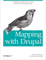
Mapping with Drupal: Navigating Complexities to Create Beautiful and Engaging Maps
 Mapping with Drupal is a concise guide shows you how to create custom interactive maps from top to bottom, using Drupal 7 tools and out-of-the-box modules.
You’ll learn how mapping works in Drupal, with examples on how to use intuitive interfaces to map local events, businesses, groups, and other custom data.
Although building maps with Drupal can be tricky, this book helps you navigate the system’s complexities for creating sophisticated maps that match your site design.
- Get the knowledge and tools you need to build useful maps with Drupal today.
- Get up to speed on map projections, the ethics of making maps, and the challenges of building them online
- Learn how spatial data is stored, input by users, manipulated, and queried
- Use the OpenLayers or GMap modules to display maps with lists, tables, and data feeds
- Create rich, custom interactions by applying geolocation
- Customize your map’s look and feel with personalized markers, map tiles, and map popups
- Build modules that add imaginative and engaging interactions
By Alan Palazzolo, Thomas Turnbull
Publisher: O'Reilly Media
Release: December 2011
Friday, January 08, 2010
Interview with Steve deRoy about the role of networking and communication in PGIS practice
In this interview, Mr. Steven DeRoy illustrates the power of networking and the importance of integrating this practice into the daily realm of PGIS. These professional exchanges create an opportunity to dialogue with likeminding professionals, allowing practitioners to share ideas and approaches to solve common challenges. Maps also play a vital role in communicating ideas amongst different parties and for advocating change in current affairs
Friday, November 13, 2009
Peter Poole reports on his experience with community mapping
In this interview, Peter Poole traces the evolution of a map-making methodology which commenced with his introduction of GPS to the Inuit community of Pangnirtung in 1989 and was incubated throughout the 1990’s by a series of ‘tenure mapping’ projects in the Amazon the Arctic and Asia. Tenure maps depict indigenous names, resources and special places on scaled maps, intended as evidence in negotiating land settlements.
Most tenure mapping methods rely upon external cartographic expertise. The “no-name” method enables communities to control the complete information cycle: gathering raw data, their conversion to information, its application.
The interview describes the search for cheap, simple, appropriate geomatic technology.
During several tenure mapping projects in the Amazon, a two-tier arrangement evolved whereby community-based teams would gather raw field data, the most critical task, and indigenous associations or support NGO’s, set up mapping units to serve the field teams.
The interview shifts focus to an overview of global community mapping completed by Peter Poole. In this, he concluded that, in terms of expertise, accessibility and accomplishment, the Philippines. He also drew a broad distinction to tenure mapping in America, a continent whose indigenous peoples sharing a in common ‘500 years since Columbus’ experience, and Africa, where this model does not work and where community mapping is taking off in a refreshing variety of directions.
The interview concludes with three lessons learned:
- Yes, communities can make their own scaled maps.
- The most successful of emerging mapping centres are those whose services are accessible to all communities.
- This capacity-building approach to map making equips and inspires people to diversify their skills in environmental information management. These skills will be wasted unless provisions are made to follow up tenure mapping projects with either further training or employment.
Friday, November 06, 2009
Dave De Vera elaborates on Participatory GIS practice in the Philippines
Dave De Vera is the Executive Director of the Philippine Association For Intercultural Development (PAFID). In his interview Dave elaborates on the use of Participatory GIS practice in the Philippines to support indigenous communities in filing ancestral land claims. He elaborates on the mapping methods used, explains why P3DM is the most effective, and arguments on the need for local ownership of the process, competency of the technology intermediary, quality work, and constructive relationships with Government. Dave further lists cases of PAFID / Government partnerships and analyses the pillars of process legitimization.
Friday, September 18, 2009
Web-Based GIS and the Future of Participatory GIS Applications within Local and Indigenous Communities
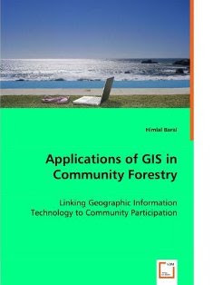
Applications of GIS in Community Forestry: Linking Geographic Information Technology to Community Participation

Wednesday, January 14, 2009
2009 PGIS / PPGIS Photo Competition launched by CTA
The competition has been launched to enrich the library with a wide variety of examples and applications from around the world. The competition allows development practitioners and researchers to share photographic records of their experiences with other peers and contribute to a product (the training kit) which will be freely available in different languages in 2010. More about the competition, its legal conditions, guidelines for submission and procedures of selection and awarding is found on the recently launched CTA web site dedicated to Participatory GIS (PGIS) practice.
Sunday, November 23, 2008
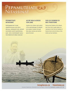
Innu Place Names Website
 Lots of place names in Labrador come from the Innu (e.g. Minipi-Lake from Minai-nipi,
meaning ‘burbot lake’), but others were given by pilots, mining companies, settlers and outfitters and were imposed on places that already had Innu names. The website will enable the Innu and members of the general public to start using the Innu place names, to learn about the meaning of the names and how to pronounce them.
Other Aboriginal groups have been doing place name research over the years, and some are in the process of publishing their own websites (e.g. James Bay Cree and Norwegian Sámi). However, Pepamuteiati nitassinat is the first, comprehensive one put on line to date.
Grand Chief Nui pointed out that “Over thirty years of research with our Elders went in to this website. It’s a gift from our Elders to younger Innu people. It’s part of our Elders’ legacy. It’s also an important part of our intangible cultural heritage that will help educate people about the richness of our history and traditions.”
The website was made possible by contributions from many institutions and agencies including multimedia company Idéeclic, Environment Canada, Parks Canada, Memorial University Linguistics, and Canadian Boreal Trust. The Innu Nation wishes to acknowledge the generous financial support of the Department of Canadian Heritage through Canadian Culture Online.
History of the website project
- The Innu place names available on the website were collected in the context of a number of research projects going back to the mid-1970s.
- The biggest source of place names for the site is a 1980 mapping project. Over 500 maps at 1:50,000 scale were cut and taped together to form two giant maps. One was laid on the gym floor at Peenamin McKenzie School in Sheshatshiu and the other in the parish hall in the former community of Davis Inlet. Older hunters were invited to walk about on these maps to point out the locations of place names as well as old travel routes, camp sites, caches, birth places and good hunting and fishing places.
- Only seven of the 34 older hunters who worked on the 1980 mapping project are still living.
- A great deal of validation work was undertaken with respect to the places names which was done by ethnolinguist, José Mailhot, and anthropologist Peter Armitage, with the collaboration of Marguerite MacKenzie, Sebastien Piwas, George Gregoire, Jean-Pierre Ashini, Basile Penashue, Tony Penashue, and several Innu Elders.
- Project managers for the website project were Kanani Penashue and Peter Armitage.
What’s on the website
- The site features a searchable database of over 500 Innu place names.
- Each place name record in the database contains information about the meaning of the name, how to pronounce it, and its location. Site users can click on an audio icon to hear the pronunciation of each place name.
- The site has an interactive map showing the locations of the place names.
- Background information on how Innu place names are constructed is presented.
- Video clips and photographs show people what the named places look like or document land use activities there.
- Audio narratives from Innu Elders and youth tell stories about events and people associated with certain place names.
- Future phases of the website will add more place names, video clips, photos, and audio stories.
Source: Press relase by Natuashish (Labrador), 21.11.08
Sunday, November 09, 2008
Indigenous Peoples and Protected Areas: Conservation Through Self-Determination
Annual Meeting of the Association of American Geographers
Las Vegas, Nevada; March 22-27, 2009
Co-sponsored by the Indigenous Peoples Specialty Group, the Cultural and Political Ecology (CAPE) Specialty Group, and appropriate regional specialty groups
Session(s) organized and chaired by Stan Stevens, Associate Professor of Geography, Department of Geosciences, University of Massachusetts, Amherst 01003
Contact: sstevens@geo.umass.edu
Deadline to contact session chair with abstract: October 9, 2008
Conference registration and abstract deadline: October 16, 2008
Papers are invited for an AAG session on the interwoven politics and political ecologies of Indigenous rights and protected area-based conservation. This is the sixth consecutive year that the Indigenous Specialty Group has sponsored and organized such sessions at the AAG annual meetings. These sessions provide a continuing venue at the AAG for discussion of conservation, difference, and social justice and for analyses of the diverse political ecologies created by the establishment of protected areas by Indigenous peoples, states, and NGOs in Indigenous peoples' territories. Participants in this year's session are invited to join previous participants in contributing theoretical and case study chapters to an edited book. Both theoretical and case study contributions are welcome.
The organizer is particularly interested in papers on the following topics:
- New Paradigm Protected Areas. Establishment, operation, and effectiveness of inclusive, participatory, new paradigm protected areas. These may include diverse types of protected areas in which Indigenous peoples' land use and participation in management is recognized.
- Critiques of Old Paradigm Protected Areas. Analyses of coercively imposed exclusionary "wilderness" or Yellowstone-model protected areas and "fortress conservation" from the standpoints of violations of human/indigenous rights; displacement; loss of access to and/or management of natural resources, cultural resources, and cultural sites; accompanying changes in land/water use and management; and consequent ecological change.
- "Hand-backs," "Hand overs," and other Reconciliation and Restitution. Case studies of redress, compensation, or restitution for past injustices against Indigenous peoples caused by the creation or management of protected areas.
- False Representations of "Progressive" Protected Areas. Analyses of protected areas which have inappropriately represented as participatory and community-based by states, intergovernmental agencies, or NGOs .
- Rights-Based Conservation. Analyses of protected area governance and management in cases where this is explicitly based on recognition of constitutional, human, and/or Indigenous Rights.
Saturday, September 06, 2008
Information and Communication Technology and Peacebuilding: Summary of a Workshop
On December 14, 2007, the National Academy of Engineering (NAE) convened a group of experts in diverse fields to consider the role of ICT in promoting peace and conflict resolution. The one-day workshop was designed to consider current and emerging technologies and strategies for employing them in conflict management and diplomacy. Giacomo Rambaldi presented a case study on "GIS and Participatory 3-D Modeling in Land-Use Negotiation" . The workshop also aimed to explore how organizations with a role in promoting peace, like the U.S. Institute of Peace, can most effectively leverage technology in carrying out their missions.
"Information and Communication Technology and Peacebuilding: Summary of a Workshop" reviews the group's discussions on number of key issues, illuminates certain practitioner needs, and suggests possible next steps.
The proceedings can be downloaded for free via this link.
Wednesday, August 06, 2008
PPGIS.net on LinkedIn to foster community development among pgis/ppgis practitioners
Since DGroups, the platform hosting [ppgis] offers limited opportunities for members to learn about each other and to e.g. get together on a country basis. Considering this limitations and the opportunities offered by emerging web 2.0 applications, I have created a parallel peer2peer space on LinkedIn. LinkedIn is a social- networking site used by professionals.
Joining this new space will allow you to easily identify and establish contact with other [ppgis] members.
The goal of this new space is to help [ppgis] members:
To easily identify members of the [ppgis] network, learn more about them and eventually establish personal contact;
Accelerate careers/business through referrals from [ppgis] Group members;Put a face and a professional curriculum behind a name or an e-mail address
Below is a short vide explaining how LinkedIn works:
Sunday, May 18, 2008
Launch of the Participatory Mapping Training Kit announced
Participatory mapping and development practitioners, activists and researchers identified the lack of training materials as a major constraint in the spread of good participatory mapping / PGIS practice. An initiative launched by CTA and other development partners will lead to the production of a modular, multimedia and multilingual training kit for trainers. The kit will ensure that participatory mapping and communication practices evolve and spread in an ethically conscious manner, ensuring that indigenous and other marginalised communities are effective in documenting, representing, and communicating their spatial knowledge, while taking a high degree of control over the process. It is understood that good practice would add value and authority to local knowledge, facilitate inter-generational knowledge exchange, contribute to building and supporting a cohesive community identity, and support sustainable planning through collaborative decision-making.

