Showing posts with label google earth. Show all posts

Tuesday, February 02, 2010

Digital Cartography

Digital Cartography from dynamicmediainstitute.org on Vimeo.

By Andrew Ellis, Alexander Wang, Students at the Dynamic Media Institute, Massachusetts College of Art and Design

Digital Cartography is a short documentary film on the transition of maps into their digital form. In this film we speak with programmer and mapmaker Jeffrey Warren from the MIT Media Lab and Dietmar Offenhuber from SENSEable City Lab at MIT. We explore the cultural, economic and technical aspects of mapmaking and how they affect the way we communicate with one another.

In our interviews with Jeffrey and Dietmar we learn about the social and geographical ramifications of building maps and how designers can implement their literacy in communication design to explore different avenues for mapping. Participatory mapping such as Open Street Maps and psychogeography and the virtual dérive are some of the themes discussed around the history and future of mapping in the digital age. Jeffrey gives us a demonstration on low cost arial photography using a helium balloon and a consumer digital camera to stitch photos onto google maps.

Friday, January 08, 2010

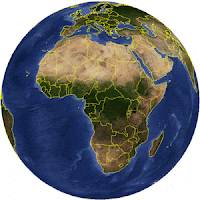
Google Earth Outreach initiative in Africa

Google Earth Outreach in Africa was recently launched with the objective of enabling non-profit and public benefit organizations in the continent to access the knowledge and resources they need to organize their data, build their maps, tell their stories through geographic visualization.

Google Earth and the various Google Geo Tools are increasingly used for communication and advocacy because of their unique ability to visually connect people to places.

By annotating Google Earth and Maps with pictures and information, organizations can tell visual and compelling stories of the work they do to the over 500 million Google Earth users.

Wednesday, January 14, 2009

2009 PGIS / PPGIS Photo Competition launched by CTA

The Technical Centre for Agricultural and Rural Cooperation ACP-EU (CTA) has launched a Photo Competition. Participants can win prices up to a maximum of EUR 900! CTA and partners are creating a multimedia multilingual training kit to support the spread of good participatory mapping practice. The training kit will promote examples of participatory mapping from around the Globe. A collection of images will be included in the photo library of the kit.

The competition has been launched to enrich the library with a wide variety of examples and applications from around the world. The competition allows development practitioners and researchers to share photographic records of their experiences with other peers and contribute to a product (the training kit) which will be freely available in different languages in 2010. More about the competition, its legal conditions, guidelines for submission and procedures of selection and awarding is found on the recently launched CTA web site dedicated to Participatory GIS (PGIS) practice.

Monday, January 12, 2009

Trading Bows and Arrows for Laptops

Chief Almir Surui asked Google for help with preserving his Amazon tribe's culture and protect his indigenous territory from deforestation. In June 2008, a team of Googlers led by Rebecca Moore of the Google Earth Outreach team went to the Amazon to train over 20 indigenous tribes on using the internet to preserve their land and their way of life.