L'Università degli Studi di Padova ha intervistato Giacomo Rambaldi nell'ambito del suo programma master sulla GIScience e le nuove tecnologie dell'informazione geografica per la sostenibilità e la cittadinanza inclusiva. Giacomo parla della sua esperienza nel praticare la cartografia partecipativa in paesi in via di sviluppo.

Showing posts with label pgis. Show all posts
Showing posts with label pgis. Show all posts
Thursday, September 07, 2023
Tuesday, May 23, 2023
‘We are our land’— Ogiek of Mount Elgon, Kenya: securing community tenure as the key enabling condition for sustaining community lands
Published in Oryx – the international journal of conservation – this open access article also highlights how this community control is under constant threat until and unless national law and practice recognizes the collective tenure rights of such communities.
"We outline how securing the community tenure rights of forest peoples can create a rapid, rights-based route to the effective and sustainable conservation of their forests. We draw on the different skillsets and experiences of the authors (long-term fieldwork, mapping and monitoring, and a lifetime of experience) to identify the conditions that enable the Ogiek of Chepkitale, Mount Elgon, Kenya, to sustain and be sustained by their lands.
We also identify the conditions that drive the disruption of this sustainable relationship through an appropriation of Ogiek resources by external interests that threaten to degrade, alienate and destroy their ecosystem. It is increasingly recognized that securing sustainable conservation outcomes can be best achieved through the deep knowledge, connection and commitment that ancestral communities have regarding their lands.
Evidence from Mount Elgon and more broadly shows that Indigenous Peoples are better guardians of their forests than international or state protection agencies. This challenges the idea that evicting forest peoples is the best way to protect forests. Other studies, including those conducted by the Kenyan governmental Taskforce on Illegal Logging, highlight the way Kenyan state agencies such as the Kenya Forest Service have been responsible for the severe depletion of Indigenous forests.
We examine how de facto collective community control can enable decisions to be made in line with taking care of community lands over the long term, but also highlight how this ability is under constant threat until and unless national law and practice recognizes the collective tenure rights of such communities."
Friday, May 19, 2023
Congrats to the #Yanesha people of #Peru for completing a fascinating #participatory 3D map of their communal reservation, part of the #Biosphere Reserve Oxapampa Ashaninka. Supported by @IUCN & @iapad, the #P3DM exercise helped documenting & reviving #traditional #knowledge pic.twitter.com/uXd0rkMtFk
— Hindou (@hindououmar) May 19, 2023
Wednesday, May 10, 2023
Evaluating Participatory Mapping Software

Evaluating Participatory Mapping provides a framework for evaluating geospatial software for participatory mapping. The evaluation is based on ten key indicators: ethics, cost, technical level, inclusiveness, data accuracy, data privacy, analytical capacity, visualization capacity, openness, and accessibility (i.e., mobile friendly or offline capabilities).
Each application is evaluated by a user and cross analyzed with specific case studies of the software’s real-world application. This framework does not discriminate against assessing volunteered geographic information (VGI) applications, as a form of participatory mapping, in circumstances that its application is spearheaded by underrepresented groups with the intent to empower and spark political or behavioral change within formal and informal institutions.
Each chapter follows a strict template to ensure that the information within the volume can be updated periodically to match the ever-changing technological environment.
The book covers ten different mapping applications with the goal of creating a comparative evaluation framework that can be easily interpreted by convening institutions and novice users.
This will also help identify gaps in software for participatory mapping which will help to inform application development in the future and updates to current geospatial software.
Monday, January 31, 2022
Managing Natural Resource Conflicts with Participatory Mapping and PGIS Applications (English Edition)
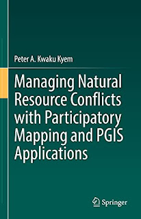
This book integrates spatial analysis into the study and management of conflicts, and offers a model in conflict studies that incorporates theoretical explanations of conflict, its causes, and impacts, with a geospatial strategy for intervening in disputes over allocation and use of natural resources (connects theory and practice). Alongside a theoretical analysis of resource conflicts and an account of Participatory Mapping and PGIS development, this book provides a case study of GIS applications in conflict mediation.
The book also lays out a practical and straightforward demonstration of PGIS applications in conflict management using a real-world case study, and traces the Participatory Mapping and PGIS movements evolution, compares PPGIS and PGIS practices, and makes distinctions between traditional GIS applications and PGIS practice. The approach embodies the enhanced use of spatial information and media, sets of tools for analysing, mapping, and displaying spatial data and a platform for participatory discussions that enhances consensus-building.
The book, therefore, contributes to the search for novel approaches for managing current and emerging conflicts. With this book, resource managers, development practitioners, students, and scholars of Participatory Mapping and PGIS applications and conflict studies will be equipped with the principles, skills, and the tools they need to manage non-violent resource conflicts and keep the disputes from slipping into violence. The book will also be a valuable text for basic and advanced studies in Participatory Mapping and PGIS applications, Conflict Resolution and Conflict Management.
Saturday, March 23, 2019
Modelling a brighter future
People with low levels of education and poor literacy skills have difficulty making themselves heard. This is particularly true for indigenous communities. Their ancestral knowledge and rights are often ignored by governments, mineral companies and others who wish to exploit their lands. However, it needn’t be like this. Working with local partners, CTA has helped to pioneer a process, known as Participatory 3-D Modelling, which is helping local communities not only to document the areas where they live, but influence the way decisions are made about land-use and tenure.
“Traditionally, maps were made by governments, and the data was controlled by governments,” says CTA’s Giacomo Rambaldi. “But there has been a huge change recently as civil society groups have acquired the ability to make their own maps and videos.” They have benefited from access to Google Earth and YouTube and participatory 3-D modelling as a way of creating accurate, geo-referenced maps.
The first CTA-supported modelling exercise in the Pacific was held in Fiji in 2005. The 11-day event in Lavuka focused on Ovalau Island, where local communities were suffering from the over-exploitation of their fishery grounds, especially by foreign fleets. During the first three days, 30 high-school students and six teachers constructed a 3-D model of the island with the assistance of 15 facilitators and trainees. Ninety men and women from 26 villages then ‘populated’ the model with mountains, roads, rivers, fishing grounds, croplands, cultural sites and other features. By the time they had finished, the model had 79 features and 83 places of cultural significance.
The model was subsequently used as a basis for an island-wide management plan and three districts management plans. The process identified 16 ‘taboo’ areas in which there is now total protection of marine life. Local people have also begun to clear ceremonial pathways which had become overgrown. During the course of three years of research, the Museum of Fiji only managed to identified 20 places of cultural significance – a quarter of the number identified by villagers during the modelling process.
In many ways, the process is as important as the finished article. “It helps people to visualise and localise their spatial knowledge, and this is very empowering,” says Giacomo. “And, of course, it enables them to make their case more persuasively.” In the past, indigenous communities might produce sketch maps laying claims to their land, but decisions-makers seldom took much notice. The 3-D models providing intricate details of landscape features and resource use are much harder to ignore.
Kenn Mondiai, who runs Partners with Melanesians, an NGO based in Papua New Guinea, was among those to benefit from training in Fiji. Since then he has played an important role in promoting participatory 3-D modelling across the Pacific. With support from the World Bank, he helped local communities on PNG’s Managalas Plateau, home to around 150 clans, to create a 3-D model of their ancestral lands. This was used as part of the evidence to promote Managalas Conservation Area, whose official recognition is anticipated around the time of going to press.
Mapping Land, Sea and Culture: an Award-winning Participatory 3D Modelling Process in Fiji from CTA on Vimeo.
In 2011, The Nature Conservancy hired Kenn to conduct trainings in the Solomon Islands. The modelling exercise at the coastal village of Boe Boe focused on climate change and its possible impact. The model showed the extent of the last tsunami in 2007 and recent king-tide levels that had inundated parts of the village. The community then used the model to discuss the potential impact of rises in sea-level and other climate-related events.
“The model showed the younger generation that we need to think about climate change,” reflected Winifred Piatamama after the exercise. “It’s important to realise that in a few years time the sea level won’t be the same as it is now.” Following discussions, the villagers decided that instead of building along the coastline, as they have done in the past, they would look towards the higher land further from the sea. In short, the model helped them to devise plans which will help them adapt to climate change.
Modelling the Future in Boe Boe Community, Solomon Islands from CTA on Vimeo.
According to Winifred, the modelling process was particularly important for the women in the community. “At the beginning it was a bit challenging for women, because they don’t raise their concerns, they are generally quiet,” she said. However, the modelling process encouraged them to share their views more openly. “When everyone contributes to the model, they share pride and ownership,” reflected Gabriel Kulwaum of The Nature Conservancy (TNC) in a short film about the Boe Boe exercise. “TNC or the government don’t own it.” The community does.
CTA was keen to encourage participatory 3-D modelling in the Caribbean, but was obliged to import expertise from elsewhere. In October 2012, the first Caribbean modelling exercise was held in Tobago, hosted by the Caribbean Natural Resources Institute (CANARI) and facilitated by Kenn Mondiai. This led to follow-up modelling workshops on Union Island and Granada.
Local voices in climate change adaptation - Union Island, Caribbean - Trailer from CTA on Vimeo.
According to Gillian Stanislaus of the Department of Natural Resources and Environment in Trinidad and Tobago, the Tobago 3-D model will help the authorities manage future developments more efficiently. “Because of the modelling process, we have a much greater depth of knowledge about the way in which the land is used and its significance for local people,” she says.
Terrence Phillips attended one of the modelling workshops – its focus was on adapting to climate change – as a representative of the Caribbean Regional Fisheries Mechanism. He was impressed. “I think this is a very useful tool,” he says. “The communities were able to describe what had happened to their marine resources in the past and the state of the resources now.” The modelling encouraged them to consider the possible impact of sea-level rises and climate change, and devise strategies to help them adapt. The modelling exercise helped to create a constructive dialogue between the government and the local community, ensuring that they work together effectively in future.
Africa’s first participatory 3-D mapping exercise took some 10 months to organise. Held in the village of Nessuit in Kenya’s Nakuru County, it was managed by Environmental Research Mapping and Information Systems in Africa (ERMIS-Africa), with financial and technical support from CTA. Over the course of 11 days in August 2006, some 120 men and women belonging to 21 Ogiek clans constructed a 3-D model of the Eastern Mau Forest Complex.
The Voice of the Ogiek from CTA on Vimeo.
The Mau Forest had suffered from decades of commercial logging and encroachment. These activities had destroyed much of the landscape, as well as many Ogiek cultural sites, and for some years the Ogiek had been attempting to assert their rights to the land in court. “The court cases had been dragging on, with no real resolution,” explains Julius Muchemi, director of ERMIS-Africa. “What the Ogiek needed was concrete evidence to support their claims, and the modelling exercise helped to provide that.”
The evidence was persuasive enough to convince the government of the Ogiek’s right to the land, and the need to protect the area from further degradation. When a conservation process was launched in 2007, all those occupying the forest apart from the Ogiek were evicted. Since then, ERMIS-Africa and its partners have produced the Ogiek Peoples Ancestral Territories Atlas. This provides the most comprehensive description to date about the Ogiek’s culture and their links to the land.
Among the organisations which supported the mapping exercise was the Indigenous Peoples of Africa Coordinating Committee (IPACC). According to its director, Nigel Crawhall, this was a key event in the life of IPACC. The mapping exercise, and CTA’s support for the organisation, led to a series of important developments for indigenous people, including IPACC’s engagement with the UN Framework Convention on Climate Change and the launching of a multi-country training programme on climate change mitigation and adaptation.
“From a professional perspective,” said Dr Crawhall, in a written summary about the impact of CTA, “the relationship with CTA has brought important changes, new tools and opportunities... Exposure and partnering with CTA has transformed the work, practice and knowledge of Africa’s only regional indigenous peoples network, it has touched the lives of people in more than a dozen countries, it has created new career and advocacy opportunities for indigenous leaders, and it has opened new horizons for me professionally.”
Since the Mau Forest mapping exercise, CTA has supported similar initiatives in Ethiopia, Gabon, Chad and Uganda. Supported by an e-handbook published in English, French, Spanish, Portuguese and Amharic, and a vibrant online community, modelling exercises have also taken place in other parts of Kenya, the Democratic Republic of Congo, Ghana and Morocco and many other countries as shown on the map below.
“Traditionally, maps were made by governments, and the data was controlled by governments,” says CTA’s Giacomo Rambaldi. “But there has been a huge change recently as civil society groups have acquired the ability to make their own maps and videos.” They have benefited from access to Google Earth and YouTube and participatory 3-D modelling as a way of creating accurate, geo-referenced maps.
The first CTA-supported modelling exercise in the Pacific was held in Fiji in 2005. The 11-day event in Lavuka focused on Ovalau Island, where local communities were suffering from the over-exploitation of their fishery grounds, especially by foreign fleets. During the first three days, 30 high-school students and six teachers constructed a 3-D model of the island with the assistance of 15 facilitators and trainees. Ninety men and women from 26 villages then ‘populated’ the model with mountains, roads, rivers, fishing grounds, croplands, cultural sites and other features. By the time they had finished, the model had 79 features and 83 places of cultural significance.
The model was subsequently used as a basis for an island-wide management plan and three districts management plans. The process identified 16 ‘taboo’ areas in which there is now total protection of marine life. Local people have also begun to clear ceremonial pathways which had become overgrown. During the course of three years of research, the Museum of Fiji only managed to identified 20 places of cultural significance – a quarter of the number identified by villagers during the modelling process.
In many ways, the process is as important as the finished article. “It helps people to visualise and localise their spatial knowledge, and this is very empowering,” says Giacomo. “And, of course, it enables them to make their case more persuasively.” In the past, indigenous communities might produce sketch maps laying claims to their land, but decisions-makers seldom took much notice. The 3-D models providing intricate details of landscape features and resource use are much harder to ignore.
Across the Pacific
Mapping Land, Sea and Culture: an Award-winning Participatory 3D Modelling Process in Fiji from CTA on Vimeo.
In 2011, The Nature Conservancy hired Kenn to conduct trainings in the Solomon Islands. The modelling exercise at the coastal village of Boe Boe focused on climate change and its possible impact. The model showed the extent of the last tsunami in 2007 and recent king-tide levels that had inundated parts of the village. The community then used the model to discuss the potential impact of rises in sea-level and other climate-related events.
“The model showed the younger generation that we need to think about climate change,” reflected Winifred Piatamama after the exercise. “It’s important to realise that in a few years time the sea level won’t be the same as it is now.” Following discussions, the villagers decided that instead of building along the coastline, as they have done in the past, they would look towards the higher land further from the sea. In short, the model helped them to devise plans which will help them adapt to climate change.
Modelling the Future in Boe Boe Community, Solomon Islands from CTA on Vimeo.
According to Winifred, the modelling process was particularly important for the women in the community. “At the beginning it was a bit challenging for women, because they don’t raise their concerns, they are generally quiet,” she said. However, the modelling process encouraged them to share their views more openly. “When everyone contributes to the model, they share pride and ownership,” reflected Gabriel Kulwaum of The Nature Conservancy (TNC) in a short film about the Boe Boe exercise. “TNC or the government don’t own it.” The community does.
Training in the Caribbean
Local voices in climate change adaptation - Union Island, Caribbean - Trailer from CTA on Vimeo.
According to Gillian Stanislaus of the Department of Natural Resources and Environment in Trinidad and Tobago, the Tobago 3-D model will help the authorities manage future developments more efficiently. “Because of the modelling process, we have a much greater depth of knowledge about the way in which the land is used and its significance for local people,” she says.
Terrence Phillips attended one of the modelling workshops – its focus was on adapting to climate change – as a representative of the Caribbean Regional Fisheries Mechanism. He was impressed. “I think this is a very useful tool,” he says. “The communities were able to describe what had happened to their marine resources in the past and the state of the resources now.” The modelling encouraged them to consider the possible impact of sea-level rises and climate change, and devise strategies to help them adapt. The modelling exercise helped to create a constructive dialogue between the government and the local community, ensuring that they work together effectively in future.
Africa's first
The Voice of the Ogiek from CTA on Vimeo.
The Mau Forest had suffered from decades of commercial logging and encroachment. These activities had destroyed much of the landscape, as well as many Ogiek cultural sites, and for some years the Ogiek had been attempting to assert their rights to the land in court. “The court cases had been dragging on, with no real resolution,” explains Julius Muchemi, director of ERMIS-Africa. “What the Ogiek needed was concrete evidence to support their claims, and the modelling exercise helped to provide that.”
The evidence was persuasive enough to convince the government of the Ogiek’s right to the land, and the need to protect the area from further degradation. When a conservation process was launched in 2007, all those occupying the forest apart from the Ogiek were evicted. Since then, ERMIS-Africa and its partners have produced the Ogiek Peoples Ancestral Territories Atlas. This provides the most comprehensive description to date about the Ogiek’s culture and their links to the land.
Among the organisations which supported the mapping exercise was the Indigenous Peoples of Africa Coordinating Committee (IPACC). According to its director, Nigel Crawhall, this was a key event in the life of IPACC. The mapping exercise, and CTA’s support for the organisation, led to a series of important developments for indigenous people, including IPACC’s engagement with the UN Framework Convention on Climate Change and the launching of a multi-country training programme on climate change mitigation and adaptation.
“From a professional perspective,” said Dr Crawhall, in a written summary about the impact of CTA, “the relationship with CTA has brought important changes, new tools and opportunities... Exposure and partnering with CTA has transformed the work, practice and knowledge of Africa’s only regional indigenous peoples network, it has touched the lives of people in more than a dozen countries, it has created new career and advocacy opportunities for indigenous leaders, and it has opened new horizons for me professionally.”
Since the Mau Forest mapping exercise, CTA has supported similar initiatives in Ethiopia, Gabon, Chad and Uganda. Supported by an e-handbook published in English, French, Spanish, Portuguese and Amharic, and a vibrant online community, modelling exercises have also taken place in other parts of Kenya, the Democratic Republic of Congo, Ghana and Morocco and many other countries as shown on the map below.
Monday, September 03, 2018
Joyful visualisation of urban P3DM by the Philippine Disaster Resilience Foundation
One of the key components of Philippine Disaster Resilience Foundation (PDRF)’s Community Resilience Program is the Participatory 3-Dimensional Mapping (#P3DM). In partnership with the Philippine Geographical Society, it is a multi-sectoral & community mapping activity.
Saturday, September 01, 2018
Urban Participatory 3D Model of Barangay, Quezon City, Philippines
Urban Participatory 3D Model (P3DM) of the Barangay Bagubayan, Quezon City, Philippines done on 23-24 July 2018 assembled by local communities in the context of the USAID-funded project "Strengthening Public-Private Partnership on Disaster Risk reduction to Build Resilient Communities". Facilitation support provided by the the Philippine Geographical Society.
Saturday, April 29, 2017
How participatory maps can inform national policy making: The Tampakan Copper-Gold mine case
On September 23, 2011, Sagittarius Mines, Inc., a joint venture between global giant Glencore, Australia's Indophil Resources, and Filipino firm Tampakan Group of Companies, organised a public consultation in Koronadal City, South Cotabato, Philippines, to present the results of a series of feasibility studies including the results of an Environmental Impact Assessment (EIA) and inherent “safety, merits and sustainability” of the planned US$5.8-billion Tampakan Copper-Gold mining Project.
The final overall mine area was estimated at around 10,000 ha located within the boundaries of four provinces, namely South Cotabato, Sarangani, Davao del Sur and Sultan Kudarat, mostly forested and including a substantial portion in the Indigenous peoples’ ancestral domains. The open pit of 500 has would have been dug to a depth of 785 meters while the topsoil stockpile and pit ore stockpile would have covered areas of 5 ha and 49 ha, respectively. The company’s EIA estimated that 5,000 people, mostly of indigenous origin, were to be directly affected, and would have required re-settlement. The mining project would have had direct impact on five watersheds, around 4,000 hectares of old-growth forest and five indigenous peoples’ ancestral domains.
 Consultants and executives of the company shared the finding of their studies using figures, charts and images all presenting the “expected benefits” of the proposed mining project, the largest of its kind in the Philippines and among the largest copper mines in the world to a an estimated 10,000 people crammed in the Koronadal City plaza.
At the other end of the spectrum, the Philippine Association for Intercultural Development (PAFID), a non-governmental organisation (NGO) supporting the cause of Indigenous Peoples and local minorities, prepared a geo-referenced and scaled relief map of the area, to translate the technical and complex information available on the reports produced by the company via a visual and tactile interface. Building on the data provided by the mining company itself (e.g., potential stockpiles of mine tailings and wastes), the physical 3D visualisation of the mining complex - once unveiled - would have shown a different, less rosy scenario. In the early morning before the start of the public consultation, the 3D map was sneaked into the plaza covered with a cloth.
The company’s experts - who included British, Australian and Filipino mining executives, were the first to present the results of the feasibility studies, environmental impact assessments and more, under the flashlight of local and national media, radio and TV operators.
When given the floor to react to the presentations, PAFID representative, Ms Kail Zingapan, unveiled the Participatory 3D model (P3DM) to the surprise of the mining executives, the large audience crowding the plaza and the local media.
Benefiting from the same media coverage as the mining executives, Ms Zingapan illustrated the actual and future scenarios of the Koronadal Valley and the Tampakan watersheds, where the mining operations would have taken place.
“This is the people’s map. We did not invent this,” she told the audience after unveiling the relief model. “Residents of the area showed us where their lands are located and we just plotted them on the 3D map,” Zingapan said. “We showed them the potential impact of the mining activities on the landscape and they saw that the mine development area would have included their ancestral lands. It appears that not all of them were consulted or correctly informed about the impact of the operations and the risks involved.”
According to local accounts, the audience was struck as Mr Zingapan further elaborated using the 3D map as a visual reference. She pinpointed that the company planned to build its tailings dam on an area, which is considered as sacred by the indigenous peoples. The location is also the headwater of the Mal River, which is the source of fish, of fresh water for home use and for irrigating crops. “This is your land where you live and get your food and other daily needs. It is up to you now if you want to see this land wasted and taken away from you or not,” she told the people in their local language. Her spoken words and image were amplified and accessible to the entire audience via the sophisticated multimedia system installed by the mining company for the occasion.
The visualisation of the pre and post scenarios offered by the 3D map were graphic, easy to understand and powerful, and underpinned public arguments contesting the company’s plans to mine copper and gold through the open-pit method.
The consultation ended, South Cotabato Governor Arthur Pingoy declared that he was duty-bound to implement the Province’s 2010 environment code, which bans open-pit mining. The mining company contested the “constitutionality” of the Province’s environment code and insisted that open-pit mining is the “safest method.” In 2014 the case, presented by the Europe-Third World Center (CETIM), was debated 26th session of the UN Human Rights Council.
In 2016, Philippine Environment Secretary Regina Lopez stated that “There will be no Tampakan mine operations under my term.” “I will never ever allow this because it’s immoral. It’s socially unjust to allow companies to put the lives of all the farmers and indigenous people at risk,” Secretary Lopez said.
On 27 April 2017, Secretary Lopez further stated that she will ban open-pit mining in the country, toughening a months-long crackdown on the sector she blames for extensive environmental damage. Among others, the ban would halt the $5.9 billion (£4.59 billion) Tampakan copper-gold project, the nation's biggest stalled mining venture. Tampakan failed to take off after the province where it is located banned open-pit mining in 2010, prompting commodities giant Glencore Plc to quit the project in 2015.
In interfacing with the press, Secretary Lopez used the same P3DM used in 2011 by Ms Zingapan to astound the audience in Koronadal City, and kick-start a process with is likely to lead to fundamental changes in the policy governing open pit mining in the Philippines.
The final overall mine area was estimated at around 10,000 ha located within the boundaries of four provinces, namely South Cotabato, Sarangani, Davao del Sur and Sultan Kudarat, mostly forested and including a substantial portion in the Indigenous peoples’ ancestral domains. The open pit of 500 has would have been dug to a depth of 785 meters while the topsoil stockpile and pit ore stockpile would have covered areas of 5 ha and 49 ha, respectively. The company’s EIA estimated that 5,000 people, mostly of indigenous origin, were to be directly affected, and would have required re-settlement. The mining project would have had direct impact on five watersheds, around 4,000 hectares of old-growth forest and five indigenous peoples’ ancestral domains.

At the other end of the spectrum, the Philippine Association for Intercultural Development (PAFID), a non-governmental organisation (NGO) supporting the cause of Indigenous Peoples and local minorities, prepared a geo-referenced and scaled relief map of the area, to translate the technical and complex information available on the reports produced by the company via a visual and tactile interface. Building on the data provided by the mining company itself (e.g., potential stockpiles of mine tailings and wastes), the physical 3D visualisation of the mining complex - once unveiled - would have shown a different, less rosy scenario. In the early morning before the start of the public consultation, the 3D map was sneaked into the plaza covered with a cloth.
The company’s experts - who included British, Australian and Filipino mining executives, were the first to present the results of the feasibility studies, environmental impact assessments and more, under the flashlight of local and national media, radio and TV operators.
When given the floor to react to the presentations, PAFID representative, Ms Kail Zingapan, unveiled the Participatory 3D model (P3DM) to the surprise of the mining executives, the large audience crowding the plaza and the local media.
Benefiting from the same media coverage as the mining executives, Ms Zingapan illustrated the actual and future scenarios of the Koronadal Valley and the Tampakan watersheds, where the mining operations would have taken place.
“This is the people’s map. We did not invent this,” she told the audience after unveiling the relief model. “Residents of the area showed us where their lands are located and we just plotted them on the 3D map,” Zingapan said. “We showed them the potential impact of the mining activities on the landscape and they saw that the mine development area would have included their ancestral lands. It appears that not all of them were consulted or correctly informed about the impact of the operations and the risks involved.”
According to local accounts, the audience was struck as Mr Zingapan further elaborated using the 3D map as a visual reference. She pinpointed that the company planned to build its tailings dam on an area, which is considered as sacred by the indigenous peoples. The location is also the headwater of the Mal River, which is the source of fish, of fresh water for home use and for irrigating crops. “This is your land where you live and get your food and other daily needs. It is up to you now if you want to see this land wasted and taken away from you or not,” she told the people in their local language. Her spoken words and image were amplified and accessible to the entire audience via the sophisticated multimedia system installed by the mining company for the occasion.
The visualisation of the pre and post scenarios offered by the 3D map were graphic, easy to understand and powerful, and underpinned public arguments contesting the company’s plans to mine copper and gold through the open-pit method.
The consultation ended, South Cotabato Governor Arthur Pingoy declared that he was duty-bound to implement the Province’s 2010 environment code, which bans open-pit mining. The mining company contested the “constitutionality” of the Province’s environment code and insisted that open-pit mining is the “safest method.” In 2014 the case, presented by the Europe-Third World Center (CETIM), was debated 26th session of the UN Human Rights Council.
In 2016, Philippine Environment Secretary Regina Lopez stated that “There will be no Tampakan mine operations under my term.” “I will never ever allow this because it’s immoral. It’s socially unjust to allow companies to put the lives of all the farmers and indigenous people at risk,” Secretary Lopez said.
On 27 April 2017, Secretary Lopez further stated that she will ban open-pit mining in the country, toughening a months-long crackdown on the sector she blames for extensive environmental damage. Among others, the ban would halt the $5.9 billion (£4.59 billion) Tampakan copper-gold project, the nation's biggest stalled mining venture. Tampakan failed to take off after the province where it is located banned open-pit mining in 2010, prompting commodities giant Glencore Plc to quit the project in 2015.
In interfacing with the press, Secretary Lopez used the same P3DM used in 2011 by Ms Zingapan to astound the audience in Koronadal City, and kick-start a process with is likely to lead to fundamental changes in the policy governing open pit mining in the Philippines.
Sec @iamGinaLopez shows the media, the proposed open pit mine in Tampakan. #MiningPH pic.twitter.com/lo9wP2CVeI— DENR (@DENR_Official) April 27, 2017
Sources:
- Jee Y. Geronimo. 2017. DENR bans 'prospective' open-pit mines. https://goo.gl/HGX9xu
- Reuters. 2017. Philippines bans open-pit mining as minister toughens crackdown. https://goo.gl/A55pm9. Thu Apr 27, 2017
- Louise Maureen Simeon. 2016. DENR thumbs down Tampakan mine project. The Philippine Star. Updated July 28, 2016. https://goo.gl/I41U88
- ________2016. Philippines: Details of the Tampakan project challenged. https://goo.gl/w9Tyln
- CETIM. 2014. The Tampakan Copper-Gold Project and Human Rights Violations in the South Cotabato, Philippines, https://goo.gl/aYuWEZ presented at the 26th session of the UN Human Rights Council, 2014
- Tebtebba via the Rights and Resources Initiative. 2012. Community maps can empower indigenous peoples to assert land rights https://goo.gl/JhNyHx
Reminder:
#ConfirmSecGina
Wednesday, April 12, 2017
Participatory 3D Modelling in Western Samoa triggers behavioural changes and climate change resilience

A participatory research was conducted between February and April 2016 to explore the effectiveness and potential of P3DM in the region. The study was done by Barbara Dovarch, PhD candidate at the Department of Architecture Design and Urban Planning, University of Sassari, Italy, sociologist and independent researcher, in partnership with the Technical Centre for Agricultural and Rural Cooperation (CTA) and Samoa’s Ministry of Natural Resources and Environment (MNRE).
This participatory impact evaluation involved diverse members of local communities and MNRE technical staff. It focused particularly on the capacity of P3DM to generate deep-seated and long-lasting behavioural changes.
The results of the study demonstrates that P3DM contributes to natural resource management and climate change resilience and showed the transformative power of the process at various levels, such as community, NGO and governmental level.
Through the P3DM process, meaningful interactions between government representatives and community members resulted in greater collaboration and mutual learning. While government representatives have changed the way they approach local communities – from ‘teaching’ to ‘listening’ – communities have also changed their attitude towards land management and development.
Download the full report via: http://bit.ly/p3dm-ws
Monday, April 10, 2017
Participatory 3D modelling as a socially engaging approach in ecosystem service assessments among marginalized communities
Land use decision making in the Suriname Upper Suriname River area knows a history of dis-
 empowerment and marginalization of the Saamaka communities inhabiting the area. Non-recognition of land rights is at the origin of this problem. This is aggravated by the increasing over-exploitation of timber resources by powerful stakeholders and the unfair distribution of timber benefits. This has left Saamakans marginalized, causing distrust and opposition among themselves and towards outsiders. Furthermore, as a result of deforestation, Saamakans face detrimental changes in the ecosystem services (ES) that support their traditional livelihoods, with important effects for their well-being.
This environment of distrust, opposition and marginalization makes it difficult to assess these concerns. Hence, an ES assessment approach that would generate salient ES knowledge while generating trust, communication among stakeholders and local capacity building was needed. In this paper we evaluate whether Participatory 3D modelling (P3DM) is an effective approach for ecosystem services assessments in such disabling environments. We evaluate this by using empirical data from an ES assessment in the Saamaka region using a P3DM approach. Results show the efficient identification and evaluation of 36 ES representing provisioning, cultural and regulating service categories with crops, fish, wild meat, timber and forest medicines identified as most important.
The authors of this paper found a decrease in the demand and supply of crops, fish and wild meat associated with ecosystem degradation, out-migration and changes in lifestyles. Further, the findings of the research show an increasing demand and decreasing supply for timber related to over-exploitation. The research provided evidence of the usefulness of P3DM to foster multi-functional landscape development among a range of communities.
In the paper the authors discuss the usefulness of the approach and the conditions needed for the P3DM process to address the needs of the local communities as well as the need for a broader P3DM implementation strategy beyond the engagement, screening, and diagnostic phases of ES assessments when the aim is to enhance ES outcomes for marginalized communities.
Download PDF version of the paper
Related posts:
- Saamaka peoples upscale the use Participatory 3 Dimensional Modelling along the Upper Suriname River, 8 August 2015
- Suriname - 15 July, 2015. Mapping the livelihoods of the Saamaka people.
- Saramakan’s forests: watercourses at the core of a Participatory 3D Modelling exercise along the Upper Suriname River
- The enabling power of participatory 3D mapping among the Saramaccan Peoples of Suriname (Video, final version)
- The film “The enabling power of participatory 3D mapping among the Saramaccan People of Suriname” launched at CWA2014
Thursday, March 23, 2017
Participatory 3D Modelling, a powerful development tool for Madagascan associations
Interview with Rajoelisolo Kotondrajaona, Secretary General of the liaison office for Rural Training Institutions - by Andriatiana Mamy
 Rajoelisolo Kotondrajaona, Secretary General of the Liaison Office for Rural Training Institutions in Madagascar (BIMTT), is an enthusiastic supporter of participatory 3-D models. Having attended the participatory 3-D modelling exercise led by a CTA team in Madagascar, he argues that this is a powerful multi-purpose tool that will be invaluable for the development of his association.
Interview by Mamy Andriatiana

You've been very keen to adopt 3-D modelling. Why do you describe it as a multi-purpose tool?
Rajoelisolo Kotondrajaona: Absolutely. Initially we were just curious because it was something new, but we've been very quick to adopt the process. Our organisation has a longstanding collaboration with CTA, and in 2015 my team and I attended training on participatory 3-D mapping delivered by Farmer Technology Agriculture (FTA), an organisation supported by CTA. We followed the process of making a village model. I was fascinated by the whole setup, the work atmosphere and especially the way that people got involved in different aspects of the process. Everyone had a specific role: children and young people cut up cardboard boxes, adults did the plotting and added factual data, and older people shared their memories about the history of the village. Everyone worked together around the map, united by the same objective of reconstituting the history and showing detailed information about the village. You could see how it pulled everyone together: young and old, technicians and practitioners, members of the community and officials from modern and traditional authorities. I suddenly realised how 3-D modelling exercises could help our association, as our main concern is to promote synergy between actions and develop collaboration between members and the outside world, while strengthening everyone's technical and pedagogical capacities. This is a fantastic tool that's going to make our work so much easier. The most important thing is not the model itself, but the effect it has, the way it creates a convivial atmosphere, broadens individual values and viewpoints, confirms the identity of the community and facilitates a process of shared discovery and joint decisions about projects ...The whole 3-D modelling process involves gathering information, analysing the situation, lobbying, awareness raising, exploration, capitalisation, decision making, territorial management, monitoring ... It really is a multi-functional tool.What is the main focus of your organisation?
Rajoelisolo Kotondrajaona: BIMTT is an association of over 90 organisations that are attached to the Council of Christian Churches in Madagascar (FFKM). These organisations may be research institutions, development agencies, NGOs, state or private technical agricultural departments, farmer groups, etc. Our main mission is to organise discussions, develop members' capacity to link up with each other and with other institutions, and strengthen their technical and pedagogical capacities so that they can work effectively to encourage initiatives and innovations in the field. We're a big network that covers the whole of the main island. It's also worth noting that the Christian community has a huge influence on development in Madagascar. Statistics show that 70% of rural training centres in Madagascar are attached to the church – although our member organisations collaborate with all farmers, regardless of their religion. What we're interested in is how activities link up with and complement each other, and how to organise interventions so that activities and organisations don't overlap. It's all about synergy – how to consolidate members, make them organisationally and economically autonomous, help them conquer local and then international markets! BIMTT provides all kinds of managerial support. Every member organisation has its own project and activities, and we're there to help them, build their capacities and strengthen their internal and external collaboration.How can P3DM help your network? How can it improve the synergy between your activities?
Rajoelisolo Kotondrajaona: One of the current weaknesses of our network is that members work in isolation, everyone's in their own little corner. We need to work together to improve the quality and quantity of our output! As artisanal sculptors know to their cost, Madagascar is seen as a kind of test country – good for a few samples but not large orders. We've got some areas where projects are vying to do the same activity in one place, but nothing next door. Our technicians worry that local people are becoming resistant to change, especially when intervening agencies contradict each other! There's a crying need for coordination, for synergy between activities, and for people to exchange ideas. All this can be done around a 3-D map. Local people, the authorities and other actors in Ampefy have started discussing how to protect Lake Itasy, which is the second biggest lake in Madagascar and is seriously threatened by environmental degradation. 3-D maps can also help those of our members that lack the resources, enthusiasm and information to get development projects off the ground. For example, during a P3DM exercise in the village of Andranomafana Betafo Antsirabe, which had recurrent problems with drinking water, discussions started around the possibility of installing a well-placed fountain that could serve the whole village. People became enthusiastic and individuals got involved. One of our main activities at the moment is helping communities where our members work to prepare communal and village development plans (CDPs and VDPs). Most of our members are closely involved in this kind of activity, and these plans are a vital development tool for communities that are seeking assistance and funding. These communities need to take responsibility for their own future, and be committed and informed so that they can engage in the development process ... Which is where 3-D modelling comes in. Our technicians are familiar with participatory 2-D mapping and doing sketches on bits of packaging, but 3-D models are so much better because they are accurate, concrete, accessible to everyone regardless of whether or not they can read, easy to understand, participatory and dynamic. They also cost half as much as CDPs, which need expensive surveys. In fact, 3-D maps are an effective tool for designing these communal development plans because they involve different village actors, encourage exchanges and discussions, gather information and show the history of the village, preventive measures to be taken and even decisions that have been made. Over time, data are updated and everyone helps put the new information on the model. They are a quick, participatory and affordable way of getting the job done. In short, they're just what people need!How has the network appropriated the P3DM process?
Rajoelisolo Kotondrajaona: After the FTA training, which was supported by CTA, our board of directors unanimously supported the idea of sharing this tool with different members of the network. BIMTT produced a documentary film about the P3DM process, which was shown on national TV, and sent every member a DVD of it. This tool is generating a lot of enthusiasm, but it'll be a few years before we have the budget or capacity to scale up the process among all our members. BIMTT has selected the first five localities where models will be produced. Three will be of mid-western villages – Atalata Vaovao, Mahiatrondro and Ampanasanatongotra in Itasy region; one model will cover the commune of Andranomafana in the central highlands of Betafo, and the last one will be of Sahoragna fishing village in the east coast of Toamasina province.How will these models be funded?
Rajoelisolo Kotondrajaona: BIMTT has not received any funding for these models apart from pedagogical and documentary support from CTA. We're not expected to fund their production – that's up to each member institution. But as I said, members are interested, and I'm hoping that this will be reflected in their next investment budget. BIMTT's mission is to support its members, and this includes helping them find financial partners for 3-D modelling. At the moment we're trying to find ways of helping with the overall costs of modelmaking. We managed to limit the time spent on 3-D mapping to two days (plus preparation) without compromising the participatory spirit of the process, and after lobbying CTA our technicians received training on ARCGIS software so that they can produce the contour maps that are needed to make the models. This is really important because these maps take up almost half of the overall budget for producing a model: the total cost per model is 1.4 million ariary (650 Euros), and the national mapping centre (FTM) sells contour maps for 800,000 ariary (250 Euros).What are your plans for the future?
Rajoelisolo Kotondrajaona: Over the next two years we plan to train at least one technician for each of our 91 member institutions. That should give us at least 200 trained technicians and about 200 models. The idea is to start training trainers so that every member will get on-the-job training as they go through the participatory model-making process, and can then train the people they go on to collaborate with. The ultimate plan is for the whole network to make 3-D models that can be used for communal and village development plans so that member organisations and communities can use them to take charge of their own development.Interview by Mamy Andriatiana
Strength from synergy: Bringing communities together to better support them
Financial partners and technical ministerial departments believe that support for rural Madagascans will be more effective if it is delivered to clusters of village and community groups, associations and communes. In 2014 the government opted for a market economy-oriented policy to promote rural development, and adopted various measures to improve the quality and quantity of outputs. One idea was to promote village associations – the bigger, the better – with associations of groups, federated associations, platforms for federations and clusters of communes. These groupings make it easier to coordinate activities and strengthen synergies between actions, and are favoured by partners and country managers as they tend to result in more secure and efficient projects and businesses and more flexible and harmonious arrangements for training, credit, finance, repayments, skill transfers and monitoring of activities. They also enable support organisations to collaborate on assistance to large associations that work in various fields. In the region of Itasy in mid-western Madagsacar, the Swiss Cooperation co-financed inter-communal cooperation through the SAHA programme and the American development agency USAID. Three communes (Ampefy, Analavory and Anosibe Ifanja) formed the 3A Miroso association. There are about 100 groups of associations listed in this region, including a group of village associations supported by the Regional Directorate for Rural Development, the Lutheran NGO FAFAFI, the Protestant NGO SAF Fjkm, the Catholic NGO ADDM, and BIMTT... The 3-D modelling process encourages community solidarity and collaboration between support organisations, and in doing so helps create greater synergy between their actions.Monday, March 20, 2017
Light at the end of the tunnel for Malagasy fishermen
Interview with Tisza Ernest,
president of a ten-member fishermen’s association in Sahoragna, Madagascar

Why do you say that P3DM came just in time for you?
Tsiza Ernest: The P3DM learning process was like a shot in the arm for the sector, the association and especially for my family. Things had been difficult for a while and we were getting really desperate, but I can't stop being a fisherman now. I have no choice but to carry on. We used to be able to make a decent living from fishing but now we need several sources of income to make ends meet. Thankfully, things have seemed a bit more hopeful since the Liaison Office for Rural Training Institutions (BIMTT) ran some sessions on participatory 3-D modelling (P3DM) in early 2016, with support from CTA. We all came away feeling that we could do something to address the problems and get fishing back on its feet again. The P3DM process helped everyone understand the situation and gave us the opportunity to think about it together around the model, exchange ideas and take appropriate measures. It was a really useful exercise because representatives from different parts of the fishing industry were there – fishermen, staff from the town hall, the Regional Directorate for Fisheries (DRP), the Saint Benoît religious community, traditional authorities, etc. All the fishermen who work in a 30km-stretch of the east coast were represented. Everyone was there.What are the problems and how can they be resolved?
Tsiza Ernest: The main issue is over-exploitation due to illegal fishing. Our output has fallen considerably over the last 10 years, and nowadays we have to go much further afield to have any hope of catching something. It's a free-for-all. There's no regulated closed fishing season, no limits on minimum or maximum sizes, no standardised equipment and no properly demarcated fishing zones. This is an emergency. It's not unusual to come across strangers or Chinese fishermen in motorboats that swallow up everything in their path. People also use floodlights in sensitive areas such as spawning grounds or large shellfish beds, and this has serious consequences – like a bushfire that displaces creatures from their habitat and makes it easier to flush them out in future. They're coming in and stealing our resources! Some people use mosquito nets instead of fishing nets, which take everything, right down to the eggs. The authorities just turn a blind eye to it. Our association has been trained on responsible marine fishing and we've adopted a convention that obliges us to respect our profession. We use conventional nets, we've stopped catching small fish, observe spawning periods, etc. – but other people don't care, so those of us who abide by the law look like idiots. We can't do anything even when we catch people red-handed, as we don't have the power to stop them or even threaten them. There doesn't seem to be any coordinated effort to crack down on illegal fishing in Madagascar, especially in our area.How can the P3DM process help this deteriorating situation?
Tsiza Ernest: Everyone has a responsibility to do something, from ministerial bodies and the regional Directorate for Fisheries to town hall officials and individual fishermen. The relevant authorities have been lobbied repeatedly, the current law condemns illegal fishing but is ignored, and the authorities seem to find it hard to get different members of the fishing industry together around the table. That's why the P3DM process is so powerful, because it brings all the protagonists together around the model at the same place and the same time. Everyone has a chance to voice their concerns, defend their position, share their ideas and put their cards on the table. That's how the idea of developing an internal convention (Dina) came up and was supported by the town hall and the Regional Directorate for Fisheries. This convention is agreed by local actors from the fishing industry at the commune and district level and should lead to the demarcation of our local marine area, proper internal organisation and discipline, a closed fishing season, standardised equipment and finally to sanctions. The idea of registering pirogues and issuing fishermen with cards also emerged during the exercise, so that we know who should and shouldn't be fishing in our waters. We were strongly advised to update the model so we can improve the Dina, so it better reflects the current situation and takes account of future changes. After validating the regulatory texts through the Dina, the town hall and DRP also plan to create a platform for all actors in our local fishing industry, to ensure that activities in this sector are properly coordinated.How will this help you and your fellow fishermen?
Tsiza Ernest: For me personally, it confirmed that what I have learned and achieved over the years still stands up. We fishermen learn everything on the job: the structure of coral and reefs, the location of lobster and prawn spawning grounds, how to identify danger areas, quicksand, etc. I was amazed that you can see all of this on the model we made together – older villagers, fishery technicians, the whole community. The model shows that our knowledge still holds true, confirms everything we know about fishing. Now I feel proud of myself, that what I've been doing for all these years stands up on a scientific basis! I'm aware that my knowledge is limited and imprecise – I had a vague idea that there were mangroves and spawning grounds in certain areas, but didn't have detailed information about their size, depth or area ... That's what's so great about the 3-D map, because it gives all the information on distance, depth, size, temperature, date, etc. And the P3DM exercise gave me ideas about what I can do in the future to reduce damage, stabilise the situation and plan projects. My family also learned a lot from the process, they've become active partners and take an interest in issues that affect marine fishing. The model showed my wife how rich our coastline is, and since then she's really helped the association lobby the municipal authorities. Our sons also learned a huge amount about the fishing environment in our area from the 3-D model – it's a quick, easy and direct way of transferring knowledge.What are your plans for the future?
Tsiza Ernest: Once things have settled down a bit, I can get on with my own plans to increase production and move into high-end products such as lobster, oysters, mussels, etc. But there's a lot to be done before that can happen: fishermen need to be trained, the value chain has to be cleaned up, resources made available, and fishermen need to work together. We also need measures to support the development of other income-generating activities during the closed season.Another thing we want to do is create a protected area within our fishing grounds, a 'marine park' that will be used responsibly and sustainably so that we can safeguard the future of our industry. This area will be a reference point, a showcase so that all our neighbours can see how environmentally sound fishing can be done. We'll need to use P3DM and make a special model of the 'park' showing all the information and especially the regulations relating to this area. During the P3DM process, the regional director of fisheries also highlighted the need to set up a federation of fishermen's associations, as this can provide an important platform for fishermen to discuss and exchange ideas and ultimately negotiate directly with different partners. I think P3DM can play a key role in getting all fishermen onto the same wavelength. And finally, I'd like all the other villages and neighbouring communes to have their own models because giving every fisherman access to the same information and knowledge will help prevent conflicts and contribute to the development of the sector.
Saturday, March 18, 2017
• Participatory 3D modelling to increase synergy between village projects and to contribute to more holistic development
Community development in Madagascar is often hampered by a lack of synergy between different local initiatives. Now project managers in areas where the Participatory 3-Dimensional Modelling (P3DM) process has been developed are hoping that this new technique can help harmonise and coordinate different development actions.
"Help! There's too much aid!" This headline on a rural affairs magazine probably stopped development project promoters and readers in the Madagascan capital in their tracks – but it reflects a growing feeling among beneficiaries that poorly coordinated interventions have created chaos rather than harmonious development. "Things would be so much better if partners gave the matter just a little concerted thought" sighed a farmer's leader in Anjazafotsy (Betafo District). The negative effects of the situation are all too clear in this rural commune of Andranomafana, where local development is confused, chaotic and hampered by resistance to change, inability to commit to projects and problems preparing development plans ...

This context makes it virtually impossible to take a holistic view of the situation and formulate an overarching development plan for the region – leaving promoters wondering how they can ensure that projects in Madagascar address beneficiaries' needs, interconnect with and complement each other, and contribute to a shared vision.

The case of two communities that had fallen out over local development in north and south Anjazafotsy shows how participatory 3-D modelling can encourage dialogue. The P3DM process drew protagonists together around a map of their two localities, enabling them to overcome their mutual mistrust and talk calmly about the issues surrounding drinking water and reforestation. They are now starting to discuss local development, and several projects are getting under way in the south. The deputy mayor noted how "The fact that everyone met around the model allowed us to start talking about the problem instead of skirting around it as we'd done before."
These 3-D models are also highly informative. Many initiatives are compromised by a lack of information that makes it impossible for actors to get organised and hard for intervening agencies to work together and coordinate activities. In Mahiatrondro, in the mid-western rural commune of Ampefy, information shown on the map about the extent of silting, lack of cultivable land and availability of nurseries alerted participants to the imminent crisis, sharpened everyone's focus on their respective tasks and galvanised them into action to prevent further environmental degradation. This common purpose created its own synergies and coordination as the community took charge of reforestation, the commune identified spaces that needed replanting, and the NGO AGRISUD provided free saplings.
Finally, these models foster solidarity, helping generate the mutual support and sense of unity needed for harmonious development. The village chief noted how the model cultivated a spirit of solidarity in the village of Mahiatrondro (population 3,000): "it was as if everyone was driven by the same spirit of mutual aid and desire to move forward together." Residents held various meetings to show what they had learned from the 3-D model of their village – from the routes used by thieves to sources of water, available land, etc. Working together enabled them to stem the resurgence of road bandits (Dahalo), reduce the damage from bush-fires, develop their own village charter (Dina) and, thanks to their courage and tenacity, get it recognised by the local court.
Having seen how participatory 3-dimensional mapping encourages synergy between development actions at the village level, there are now calls to model larger areas covering one or more communes in order to create synergies on a much larger scale.
Article by Andriatiana Mamy
"Help! There's too much aid!" This headline on a rural affairs magazine probably stopped development project promoters and readers in the Madagascan capital in their tracks – but it reflects a growing feeling among beneficiaries that poorly coordinated interventions have created chaos rather than harmonious development. "Things would be so much better if partners gave the matter just a little concerted thought" sighed a farmer's leader in Anjazafotsy (Betafo District). The negative effects of the situation are all too clear in this rural commune of Andranomafana, where local development is confused, chaotic and hampered by resistance to change, inability to commit to projects and problems preparing development plans ...

Lack of coordination
Unbalanced development is one of the first signs of a lack of coordination that has left some communities in certain areas inundated with projects while their neighbours have none. The commune of Andranomafana is a case in point, as there are five projects in the north of this small community (48 km²) and none in the south. One woman thinks this is because "people the south are less educated as they're a long way from the highway," but deputy mayor Solofo Marc Rakotondrafara blames it on lack of coordination, arguing that intervening agencies are disorganised and choose their intervention areas and themes without consulting other actors. Rajorosoana Razafimahatratra, a technician with the Liaison Office for Rural Training Institutions (BIMTT) reckons that "Everyone's out for themselves, there are no understandings between different agencies". Local people are baffled as to why two projects are getting ready to conduct similar activities in the same village – one providing drinking water while the other tackles open defecation. The village chief thinks "it would have been better to combine both activities in a single water and sanitation project, which would avoid creating divisions between beneficiaries and make it much easier to mobilize people behind the project." The situation is exacerbated by the fact that poor organisation affects the quality of services, and contradictory messages sent out by these development projects make many beneficiaries reluctant to engage with them. The administration encourages people to register their parcels at the local land office in order to obtain land certificates, but they still can't get credit because financial institutions don't recognise these certificates. "I wish they'd come to some kind of agreement" said one farmers' leader who needs money to fund his next production cycle. While technicians worry that this situation will make local people resistant to innovation, project beneficiaries are not the only ones who are missing out – the managers of development programmes are finding it increasingly difficult to get their initiatives off the ground. The regional director of rural development in Miarinarivo, Serge Andriamiarinera, says that preparing development plans for his constituency is a real challenge: "It's hard to set up development projects when all the project promoters have different, sometimes conflicting visions."This context makes it virtually impossible to take a holistic view of the situation and formulate an overarching development plan for the region – leaving promoters wondering how they can ensure that projects in Madagascar address beneficiaries' needs, interconnect with and complement each other, and contribute to a shared vision.

The P3DM process to the rescue!
A possible solution to this embarrassing situation may have been found in the three regions of the main island where participatory 3-dimensional modelling (P3DM) has been developed. BIMTT secretary general Rajoelisolo Kotondrajaona sees P3DM as a unifying process that can encourage greater synergy between village development actions: "P3DM can play a major role in local development ... In fact, I'd say this is its primary purpose, as the three pillars of the process – dialogue, information and solidarity – provide everything that is needed for greater synergy." Participatory modelling is a powerful tool for coordination that encourages dialogue between different actors, provides reliable factual information about the intervention area, and fosters a spirit of solidarity in the action zone.The case of two communities that had fallen out over local development in north and south Anjazafotsy shows how participatory 3-D modelling can encourage dialogue. The P3DM process drew protagonists together around a map of their two localities, enabling them to overcome their mutual mistrust and talk calmly about the issues surrounding drinking water and reforestation. They are now starting to discuss local development, and several projects are getting under way in the south. The deputy mayor noted how "The fact that everyone met around the model allowed us to start talking about the problem instead of skirting around it as we'd done before."
These 3-D models are also highly informative. Many initiatives are compromised by a lack of information that makes it impossible for actors to get organised and hard for intervening agencies to work together and coordinate activities. In Mahiatrondro, in the mid-western rural commune of Ampefy, information shown on the map about the extent of silting, lack of cultivable land and availability of nurseries alerted participants to the imminent crisis, sharpened everyone's focus on their respective tasks and galvanised them into action to prevent further environmental degradation. This common purpose created its own synergies and coordination as the community took charge of reforestation, the commune identified spaces that needed replanting, and the NGO AGRISUD provided free saplings.
Finally, these models foster solidarity, helping generate the mutual support and sense of unity needed for harmonious development. The village chief noted how the model cultivated a spirit of solidarity in the village of Mahiatrondro (population 3,000): "it was as if everyone was driven by the same spirit of mutual aid and desire to move forward together." Residents held various meetings to show what they had learned from the 3-D model of their village – from the routes used by thieves to sources of water, available land, etc. Working together enabled them to stem the resurgence of road bandits (Dahalo), reduce the damage from bush-fires, develop their own village charter (Dina) and, thanks to their courage and tenacity, get it recognised by the local court.
A holistic vision of territorial development
One of the most valuable aspects of P3DM is its ability to create a holistic representation that includes the socio-cultural, economic and environmental aspects of a particular area. The bird's-eye view provided by the models gives all participants a shared perspective of their locality and, according to one BIMTT technician, "generates natural synergies." Having seen the results of the P3DM process in Miarinarivo, the regional director of rural development is keen to scale it up across all the areas under his jurisdiction. "I'm setting up a regional development project, and know that it will be greatly helped by the information the model provides, the atmosphere it creates and the dialogue it generates." He emphasises the important role that a global vision of the community, the land and the natural resources in the locality plays in producing a comprehensive and relevant development plan. "It enables us to take account of every aspect of the situation, ensure that projects don't overlap with each other and inform intervening agencies about what their counterparts are doing." On the east coast of Madagascar, the Director General for Fisheries, Jean Razafimandimby, is encouraging other areas to produce participatory models as they provide invaluable marine data that can be used to make informed decisions and coordinate actions to promote responsible fishing in this severely threatened marine area. Actors in the marine fishing sector, such as the Regional Directorate for Fisheries, officials in Fenerive-Est town hall, operators and fishermen are planning a workshop to discuss how to coordinate actions and take measures against illegal fishing in the commune.Having seen how participatory 3-dimensional mapping encourages synergy between development actions at the village level, there are now calls to model larger areas covering one or more communes in order to create synergies on a much larger scale.
Article by Andriatiana Mamy
How Participatory 3D Modelling has contributed to women’s personal development in Madagascar
Rural women in Ampefy and Analavory are emerging from years of years of subordination and passivity, taking charge of their own development and overcoming numerous obstacles to their emancipation. Their key role in regional development is increasingly recognised by the administrative and traditional authorities, development partners and the local community. This article shows how participatory 3-D modelling helps women fulfil their potential.
Rural development agents on a field visit to see how silting has damaged rice fields in Atalata Vaovao, a fokontany (neighbourhood) in Ampefy commune in the Itasy region of mid-western Madagascar, wondered what could have driven a pregnant woman to walk over 8 km to join them at the site. When asked what had prompted her to carry a heavy bag for several hours under the blazing sun, enduring the long journey without a word of complaint, she pointed to the badly eroded slope opposite. “Look at the damage it’s done! This hill has silted up all our rice fields. And I’m not going to stand by quietly while nothing is done to deal with this monster!” That was their introduction to Jeannette Raharimalala, a founding member of Tolotra local development committee (KF), a 10-member association created to raise awareness of the need for social and economic development in the neighbourhood. Although Tolotra is open to men, two-thirds of its members are women – individuals whose dynamism has astonished the regional director of FAFAFI, an NGO that supports development committees. Praising their “fearless and increasingly bold and enterprising approach”, she noted that “they’ve been active for several years but have made huge progress since 2015, when they first became involved in the P3DM process.”

Article written by Interview by Mamy Andriatiana for CTA
But despite everything they do, women are under-valued, held in low regard and dominated by men, even in the household. The DG of the Ministry for Population laments the fact that "when a married couple come home after a hard day's work, the woman cannot rest as she's expected to do everything while her husband reads the paper." Women cannot access or inherit land, which is regarded as the men's domain, and are told "whether you're smart or stupid, you're still a wife." They run the risk of being left empty-handed if their marriage ends in divorce, and cannot get credit because they have no collateral (land or property) to offset possible loans. The current law states that all individuals (men and women) have equal rights to ownership, exploitation and inheritance and an equal share of matrimonial property, but social customs, taboos and a lack of implementing legislation mean that in reality, women in Madagascar have far fewer rights than men.
Rural development agents on a field visit to see how silting has damaged rice fields in Atalata Vaovao, a fokontany (neighbourhood) in Ampefy commune in the Itasy region of mid-western Madagascar, wondered what could have driven a pregnant woman to walk over 8 km to join them at the site. When asked what had prompted her to carry a heavy bag for several hours under the blazing sun, enduring the long journey without a word of complaint, she pointed to the badly eroded slope opposite. “Look at the damage it’s done! This hill has silted up all our rice fields. And I’m not going to stand by quietly while nothing is done to deal with this monster!” That was their introduction to Jeannette Raharimalala, a founding member of Tolotra local development committee (KF), a 10-member association created to raise awareness of the need for social and economic development in the neighbourhood. Although Tolotra is open to men, two-thirds of its members are women – individuals whose dynamism has astonished the regional director of FAFAFI, an NGO that supports development committees. Praising their “fearless and increasingly bold and enterprising approach”, she noted that “they’ve been active for several years but have made huge progress since 2015, when they first became involved in the P3DM process.”

Rural women overshadowed by men
Like their sisters in other regions of Madagascar, rural women in Atalata Vaovao are used to living in the shadow of their husbands and brothers. Men have jobs, go to the office and attend meetings, while women stay at home to look after the children, prepare meals, serve their menfolk and then retreat to the kitchen. Few women work in offices or lead organisations, and those who speak in public are frowned upon in rural Madagascar. The two main concerns for local people in this highly productive volcanic area are the land shortages and tenure issues left by the French colonial authorities, and the increasingly pressing problem of silting in their paddy fields. Recent efforts to grow out-of-season vegetables in these parcels have fizzled out and they now yield little more than weeds and stones. The community leader in Atalata, Félecitin Rakotoarimalalais, worries that “if nothing is done, my area alone stands to lose 30 hectares of rice fields in less than 10 years.” And if that wasn’t bad enough, Lake Itasy, which is the main source of income for many local people, is filling up with alluvium “so we have to travel further to catch increasingly small fish.” When the Liaison Office for Rural Training Institutions (BIMTT) introduced 3-D mapping exercises to help resolve potential conflicts in Itasy Region, the women of Atalata Vaovao were the first to turn their hand to the task despite the many constraints they face. Led by BIMTT technicians, supported by CTA and working alongside various representatives of the village, Ampefy town hall and development agencies, these women played an active role in a process that sharpened their already considerable appetite for development.From personal development...
The 3-D model of Atalata Vaovao could not have been built without the local women, who played a key role in mobilizing community members of all ages behind the exercise. BIMTT technician Rajorosoana Razafimahatratra recalled how they acted as convenors and facilitators, “working in the corridors and leading with a quiet strength.” You’d hear them moving things along, galvanising everyone into action: “Come along now! Where’s so-and-so gone? See where they are! Can you remember what to do? You’re the only one who knows how to do it!” Making 3-D models calls for the same kind of skills needed to organise the cooking, cleaning and laundry and get children off to school every day – and the women involved in this exercise proved much more enterprising, practical and pragmatic than the men in terms of their attention to detail, process, form, design, maintenance, getting the precise location of paths, springs and streams, updating information etc. Although the men were initially involved, it was the women who were really in charge and were best at making the model! The BIMTT technician also noted how “it improved their self-esteem and built mutual trust.” Women saw the invitation to join the model-making process as a form of recognition for their efforts. Aline Andriamampandry, secretary of the Mahiatrondro group, said that “being asked to participate means we can actually do something!” They were delighted to be able to express themselves, give an opinion, and above all be listened to. When the model was presented to the authorities and visitors (vazaha), they stood their ground like students defending their final thesis. Josephine Rasoanarilalaina, President of the Miavotra group admitted “I never thought I could do something like that!” Madagascan culture has always regarded making things as men’s work, but these women see things differently now and are determined to claim their rights. Some women from Ampefy have started land litigation procedures, while others are participating in regional elections in order to spread their ideas about development.... to social development
Women’s personal development contributes to local social and economic development. Individual women and their groups are now recognised and consulted by their own and other communities. The communal authorities ask them about local development issues, and they act as an interface between development projects and beneficiaries. The manager of one drinking water project reported that “We use their groups whenever we need to do local awareness-raising exercises,” and said they have had a noticeable effect on community development. In the village of Mahiatrondro in the commune of Analavory, discussions sparked by the model have alerted people to the dangers of environmental degradation and are starting to have an impact on their way of thinking. Neighbourhood leader Justin Razafindrakoto reports that bushfires have halved and open defecation has been eradicated in the last two years. The 3-D model helped identify areas needing reforestation, and 1,000 saplings have been planted as part of an ongoing collaboration with the AgriSud project, which provides young plants. Having learned about the increasing scarcity of available land from the P3DM process, women have been quick to diversify their activities and started rearing livestock, fattening ducks, developing village granaries, producing and selling craftwork and acting as tourist guides. A local security service has also been set up and is now recognised by the regional court. |
| Aline R. Secretaire du Comité pour le Développement du Village de Mahiatrondro, Commune d'Ampefy |
The knock-on effects of these experiences
The development committees in Ampefy and Analavory seem to be unstoppable! Their efforts are having knock-on effects in their own neighbourhood, and have spawned several sub-committees that are working on further community development initiatives. The neighbourhood chief was so impressed by the nine new groups (KF) that have been set up in the last two years that he incorporated them into the formal structure of his constituency, and their dynamism prompted the town hall to promulgate a communal order appointing KF members as Village Development Agents (VDAs). Their influence extends beyond their own commune to others in the district of Analavory, where their 3-D model was presented at the regional fair. Several other villages and communes in the district now intend to set up their own development committees, and these committees have become a focus for local development across the whole region of Itasy. The regional director of FAFAFI thinks the results speak for themselves. She believes that “personal development has a lasting impact on the individuals concerned and encourages sustainable community development,” and that “women are capable of doing incredible things with the right moral and technical support.” At least one technician has been made available to work with women throughout the whole P3DM process, which is regarded as a very promising initiative by the Ministry for Population and Women’s Advancement. Its Director General, Kidja Marie Francine, has promised to support actions that help empower women.Article written by Interview by Mamy Andriatiana for CTA
Gender inequality in Madagascar, where the law provides little protection for rural women
Women represent 50.6% of the population in Madagascar, where 62% of women and 68% of men are active on the labour market, especially in the informal sector. Rural women are always on the go, spending 16 to 18 hours a day on domestic chores such as housekeeping, preparing meals, husking rice, collecting water and wood, looking after children and working in the fields. Around 78% of women work in the agricultural sector, where they produce over half of all food crops.But despite everything they do, women are under-valued, held in low regard and dominated by men, even in the household. The DG of the Ministry for Population laments the fact that "when a married couple come home after a hard day's work, the woman cannot rest as she's expected to do everything while her husband reads the paper." Women cannot access or inherit land, which is regarded as the men's domain, and are told "whether you're smart or stupid, you're still a wife." They run the risk of being left empty-handed if their marriage ends in divorce, and cannot get credit because they have no collateral (land or property) to offset possible loans. The current law states that all individuals (men and women) have equal rights to ownership, exploitation and inheritance and an equal share of matrimonial property, but social customs, taboos and a lack of implementing legislation mean that in reality, women in Madagascar have far fewer rights than men.
Friday, January 06, 2017
Opportunity for PGIS practitioners to map Batak ancestral lands and indigenous peoples’ and community conserved areas and territories (ICCAs) in Northern Palawan, the Philippines
The Coalition against Land Grabbing (CALG) is a national coalition of indigenous peoples and local communities based in the province of Palawan (the Philippines). CALG is looking for young PGIS practitioners to help mapping Batak ancestral lands and ICCAs in northern Palawan. Specifically, they seek support for GPS-based resources inventories, geotagging of relevant locations (hunting grounds, upland farms, ritual sites, etc.).
 One aim of the project is to generate interactive maps that could serve to raise awareness on how the Batak of Palawan manage and perceive their cultural landscape. The interactive display of satellite imagery, enriched with location-based multimedia and other layers of information, would also provide evidence of on-going threats to forest resources and Batak livelihood and cultural integrity.
Social cartography, emphasizing culturally distinct understanding of landscape, will be overlapped with geo-spatial maps. The former will include the use of local place names, information on the actual and historical land uses, oral traditions, cosmovisions and testimonies linked to short video-clips syndicated from Google Video or You Tube, photographs (via Panoramio) and text.
CALG envisages that these maps would become the discursive patrimony of the Batak indigenous people and provide them with the necessary legal evidence to apply for Certificates of Ancestral Land Titles (CALTs) and to have their ICCAs included in the ICCA Registry of the United Nations Environment Programme-World Conservation Monitoring Centre (UNEP-WCMC).
The project is on-going and it will end in June 2018. Assistance for geotagging and mapping is particularly sought during the dry season (between February and May 2017), depending on the availability of PGIS practitioners. Due to global climate changes, dry season is not necessarily confined to the period mentioned above, but could also extend up to June.
selected candidates will receive free food and lodging during the research, domestic travel costs will be reimbursed and a basic honorarium based on Philippine’s standards will be provided.
During the various stages of project implementation CALG and PGIS practitioners will closely collaborate with the Batak Federation (Bayaan it Batak kat Palawan – BBKP).
Those interested can approach the Coalition against Land Grabbing (CALG) through this email address: calgpalawan@gmail.com
Most recent CALG geotagged reports
Thursday, January 05, 2017
Knowledge like water: nurturing growth Participatory 3D mapping in North Darfur
North Darfur is a dry, dusty place for much of the year; but when it rains, it comes alive with greenery. Wadi El Ku, a seasonal watercourse, suddenly flows providing water to thousands of people, their livestock and crops, which is the lifeline or breadbasket in El Fasher town, the capital of North Darfur, home to approximately 700 thousand people.
However, in the past 20 years, there has been widespread environmental degradation compounded by climate change. This video animation shows how local communities have been joining forces to find solutions, particularly as they relate to water scarcity and poor water management.
Knowledge like water: nurturing growth - Participatory 3D mapping in North Darfur from CTA on Vimeo.However, in the past 20 years, there has been widespread environmental degradation compounded by climate change. This video animation shows how local communities have been joining forces to find solutions, particularly as they relate to water scarcity and poor water management.
The participatory mapping activity described in this video took place in 2015, in the framework of the European Union-funded 'Wadi El Ku Catchment Management Project for Livelihoods Development and Sustainable Peace' project and has been facilitated jointly by the United Nations Environment Programme (UNEP), Practical Action and CTA.
Find out more
See photos and further details about the project 'The Wadi El Ku Catchment Management Project (WEK) for Livelihoods Development and Sustainable Peace'Read more about the project on UNEP's website
Watch the video animation in French or in Arabic
Stay connected
Follow PGIS on Facebook and TwitterWednesday, December 28, 2016
Life on the move - Pastoral life and livestock cross-border trade in Northern Uganda through the lens of participatory mapping
Cross-border livestock trade in dryland eastern Africa significantly contributes to the enhancement of food security and generation of wealth. It supports the livelihoods of a wide range of actors including pastoralists, livestock traders and processors.
In this context the International Institute of Rural Reconstruction (IIRR) with finalcial and technical support provided by the Technical Centre for Agricultural and Rural Cooperation (CTA), organised a P3DM workshop to identify key spatial characteristics of the livestock trading routes and marketing practices and bring the different stakeholders (including local authorities) around the same table, share information, discuss challenges and envisage mutually beneficial solutions.
The participatory mapping activity took place in Amudat in August 2016 and focused on the Achorichori Micro-catchment in Karamoja which includes Achorichor, Loroo, Amudat and Moruita Parishes. The area falls within the belt of livestock migratory movement, farmlands, cross-border livestock trade, grazing lands and water points. The mapped area covers approximately 546 sq. km.
The mapping exercise helped identify and locate wet and dry season grazing areas, farmland, forests and patchy pastures. Point items include schools, functional and non-functional boreholes, heath facilities, market places, maize mills, police posts but also churches, shrines and small gardens. Community representatives located on the 3D map all features they consider as important to the ir livelihoods. Their feedback about the mapping process are captured in the film.
Other participating organisations included:
ERMIS Africa, Kenya (P3DM facilitation)
ESIPPS International, Uganda (GIS support)
Vision Care Foundation (VCF), Uganda (community mobilizing)
French version of the film:
Friday, September 02, 2016
Powerful maps: how building 3D models is helping rural communities to make their voices heard
A process of building three-dimensional physical models in a village setting is helping to bring together traditional and modern scientific knowledge to tackle challenges ranging from soil degradation to land use planning, and from forest management to climate change. The technique, known as Participatory 3-dimensional modelling (P3DM) enables marginalised communities to present their territory – together with their own valuable knowledge – in a visual form, offering them the opportunity to protect precious natural resources from outside threats and preserve them for future generations. Some of the field experiences have been published in a new report. The Power of Maps: Bringing the third dimension to the negotiation table is published by the Technical Centre for Agricultural and Rural Cooperation (CTA), which has been in the forefront of promoting the practice across African, Caribbean and Pacific (ACP) countries.
Developed in the early 1990s in Southeast Asia, P3DM is rapidly gaining ground in other parts of the developing world. Participatory 3D models, made out of cardboard and illustrated with coloured paints, pushpins and yarn, portray land cover, such as farmland, rivers and forests, as well as other features, including coastal resources and sea depth. Uniquely, they also depict traditional knowledge, such as ancestral land rights and sacred places. These features are generally supplied by elders in the community, while younger members build the map itself. The result is a free standing relief model which provides tangible evidence of local knowledge, serving as an effective tool for analysis, decision-making, advocacy, action and monitoring.
“Knowledge built up over time and passed from generation to generation represents a unique asset for rural communities when it comes to their land, forest and aquatic resources,” said CTA Director Michael Hailu. “The ability to collate and geo-reference local knowledge and represent it in the form of 3-dimensional maps offers a unique opportunity for local communities to have a voice in decisions on how to sustainably manage their resources.”
 Often, the process of participatory 3-dimensional modelling is in itself empowering, bringing communities and generations together and helping them to visualise the extent of their resources, and how climate change and other threats, such as mining and deforestation, may be affecting them. Once completed, the physical model remains with the community.
Case studies presented from Ethiopia, Fiji and Madagascar show how P3DM has led to the development of community-driven natural resource management plans. Other examples of P3DM initiatives described in the book demonstrate how the technique can give marginalised rural people a voice to make their case heard. In the Democratic Republic of Congo, the Bambuti-Batwa pygmy community used a P3DM exercise to drive talks on what they claim is the injustice of being evicted from the territory they had inhabited for generations.
Three-dimensional mapping has helped the Kenyan hunter-gatherer Ogiek tribe to document its ancestral land rights and knowledge systems. Meanwhile, In Tobago, a Caribbean island that has suffered a series of extreme climate events in recent years, P3DM has been used to guide community-driven disaster risk reduction strategies.
South-South cooperation is helping to make the practice of participatory 3-dimensional modelling become better known and CTA has been closely involved in efforts to share training and facilitation between Caribbean and Pacific Islands and a range of African countries.
Experiences of P3DM can generate other benefits, such as offering new skills and self-confidence to individuals engaged in the process and funding for communities to implement activities. A case in point is Grenada, where a participatory 3D model had a direct impact on the community that created it, by mobilising donor funding for climate change adaptation on a stretch of the coastline badly affected by hurricane damage.
“Participatory 3D modelling, the process documented in this book, has proved to be successful in eliciting substantial amounts of what is termed as tacit knowledge from individuals, to collate individual world views into a shared, visible and tangible representation of collegial knowledge,” said Senior Programme Coordinator Giacomo Rambaldi, who has led CTA’s involvement in P3DM. Adding ‘location’ to any piece of information or datum makes it even more relevant. Hence P3DM enables knowledge holders to visualise and geo-reference their traditional knowledge and to engage outsiders in a peer-to-peer dialogue.”
You can order a hard copy and download the book.
Developed in the early 1990s in Southeast Asia, P3DM is rapidly gaining ground in other parts of the developing world. Participatory 3D models, made out of cardboard and illustrated with coloured paints, pushpins and yarn, portray land cover, such as farmland, rivers and forests, as well as other features, including coastal resources and sea depth. Uniquely, they also depict traditional knowledge, such as ancestral land rights and sacred places. These features are generally supplied by elders in the community, while younger members build the map itself. The result is a free standing relief model which provides tangible evidence of local knowledge, serving as an effective tool for analysis, decision-making, advocacy, action and monitoring.
“Knowledge built up over time and passed from generation to generation represents a unique asset for rural communities when it comes to their land, forest and aquatic resources,” said CTA Director Michael Hailu. “The ability to collate and geo-reference local knowledge and represent it in the form of 3-dimensional maps offers a unique opportunity for local communities to have a voice in decisions on how to sustainably manage their resources.”

Case studies presented from Ethiopia, Fiji and Madagascar show how P3DM has led to the development of community-driven natural resource management plans. Other examples of P3DM initiatives described in the book demonstrate how the technique can give marginalised rural people a voice to make their case heard. In the Democratic Republic of Congo, the Bambuti-Batwa pygmy community used a P3DM exercise to drive talks on what they claim is the injustice of being evicted from the territory they had inhabited for generations.
Three-dimensional mapping has helped the Kenyan hunter-gatherer Ogiek tribe to document its ancestral land rights and knowledge systems. Meanwhile, In Tobago, a Caribbean island that has suffered a series of extreme climate events in recent years, P3DM has been used to guide community-driven disaster risk reduction strategies.
South-South cooperation is helping to make the practice of participatory 3-dimensional modelling become better known and CTA has been closely involved in efforts to share training and facilitation between Caribbean and Pacific Islands and a range of African countries.
Experiences of P3DM can generate other benefits, such as offering new skills and self-confidence to individuals engaged in the process and funding for communities to implement activities. A case in point is Grenada, where a participatory 3D model had a direct impact on the community that created it, by mobilising donor funding for climate change adaptation on a stretch of the coastline badly affected by hurricane damage.
“Participatory 3D modelling, the process documented in this book, has proved to be successful in eliciting substantial amounts of what is termed as tacit knowledge from individuals, to collate individual world views into a shared, visible and tangible representation of collegial knowledge,” said Senior Programme Coordinator Giacomo Rambaldi, who has led CTA’s involvement in P3DM. Adding ‘location’ to any piece of information or datum makes it even more relevant. Hence P3DM enables knowledge holders to visualise and geo-reference their traditional knowledge and to engage outsiders in a peer-to-peer dialogue.”
You can order a hard copy and download the book.
Subscribe to:
Posts (Atom)